Know Your Farmer, Know Your LocaleSM
* Locale - noun [loh-kal] A place or locality, including the events, people, food & wine associated with it.
Adjust Text:  a a a a
 
  
Search by Locale Name or Locale ID    
(e.g. Rivenrock Gardens or CA0002)
Search by Keyword  

Product Suppliers 
 
> Utah
Business type: Agricultural Support Business

Not accepting new reviews  |  Visit Website
  Tell a friend!

Food Desert Locator

Locale ID DC9999

Run by
  new    popular 

About

Objectives

The objectives of the Food Desert Locator are:

to present a spatial overview of where food-desert census tracts are located; to provide selected population characteristics of food-desert census tracts; and to offer data on food-desert census tracts that can be downloaded for community planning or research purposes. How is a food desert defined?

The HFFI working group defines a food desert as a low-income census tract where a substantial number or share of residents has low access to a supermarket or large grocery store:

To qualify as a “low-income community,” a census tract must have either: 1) a poverty rate of 20 percent or higher, OR 2) a median family income at or below 80 percent of the area's median family income; To qualify as a “low-access community,” at least 500 people and/or at least 33 percent of the census tract's population must reside more than one mile from a supermarket or large grocery store (for rural census tracts, the distance is more than 10 miles). What can users do with the Locator?

Create maps showing food-desert census tracts; View statistics on selected population characteristics in food-desert census tracts; and Download census-tract level data from food-desert tracts. How is the Food Desert Locator related to the Food Environment Atlas?

The Food Desert Locator maps and provides selected population characteristics of census tracts that are food deserts—low-income neighborhoods without easy access to a supermarket or large grocery store. These characteristics are provided only for census tracts that meet the definition of a food desert.

The Food Environment Atlas provides a wider set of statistics on food choices, health and well-being, and community characteristics for all communities in the U.S. While the Food Desert Locator provides information at the census tract level, the smallest geographic level of data in the Food Environment Atlas is the county. The Food Environment Atlas also has an Advanced Query tool that allows users to identify and map counties sharing the same degree of multiple indicators.

Click for Locale Profile


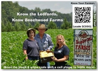
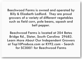
Look For "Shelf Talker" Grower Cards At Food Stores

Are you the grower? To order Shelf Talker business cards which can be customized and feature grower information
on the reverse of the card (see images below) please check out these resource pages:

Know Your Farmer Shelf Talker with QR Code* by Top10ProduceLLC   |   Browse Traceability Business Cards
Know Your Farmer Shelf Talker with QR Code profilecard Know Your Farmer Shelf Talker with QR Code profilecard
* QR Code is registered trademark of DENSO WAVE INCORPORATED


Last Update: May 4, 2011


NOTE: We are updating profiles as quickly as we can - but if you would like to request that we update a grower's locale profile immediately, CLICK HERE and put in the Locale ID (i.e. CA5005) and we will update the requested profile immediately.

We also provide a printable PDF of the instructions for How To Add A Business and How To Add A Produce Item to the site.


About Us | Contact Us | FAQ | Terms Of Use | Privacy Policy | Bookmark This Site

Copyright © 2024 All rights reserved.